+91-1902-252182, 253050, 252750, +91-9816023004 info@himalayanadventuresindia.com, roopunegi@gmail.com

Manali – Chandertal – Leh Cycle Tour

0
Price
Price
Full Name*
Email Address*
Your Enquiry*
Save To Wish List

Adding item to wishlist requires an account

5738

Why Book With Us?

  • No-hassle best price guarantee
  • Customer care available 24/7
  • Hand-picked Tours & Activities

Get a Question?

Do not hesitate to give us a call. We are an expert team and we are happy to talk to you.

+91-1902-253030, 252182, +91-9816023004

info@himalayanadventuresindia.com

Max People : 28
Tour Details

Regions: Manali – Lahaul – Leh & Ladakh     
Season: July to September
Duration: 10 Days
Type: Bicycle Tour

Itinerary

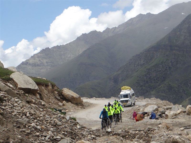
Day 1:Manali – Chandratal (4270 mts) drive by jeep over Rohtang pass (3978 mts) & Kunzam Pass (4551mts) 125 km (5-6 hrs):

As we start our journey, leaving the lush green countryside of Manali towards Rohtang Pass (3,978 Mts.). Rohtang Pass – Few places on the Earth can mark so dramatic a change in landscape as the Rohtang Pass. To one side, the lush green head of Kullu Valley; to the other, an awesome vista of bare, chocolate – colored mountains, hanging glaciers and snowfields that shine in the dazzlingly crisp fight. As we cross to the other side and at place called Gramphu we leave the main Leh – Manali Highway and enter into another Valley (Chandra Valley) and continue driving on a non-metalled road, all along the Chandra River. Slowly the Valley opens and we get introduced to magnificent Himalayan Ranges of Chandra & Bhaga, famously called as CB Range. This area in particular is very popular for Mountain Expeditions. The route veers to the left of the base of the immense Bara Shigri Glacier – Nearly 28-Km and several kilometers wide at its widest, the Bara Shigri is the largest glacier of the Lahaul Valley of Himachal Pradesh. It opens out onto the Chandra Valley and adds its waters to the River. It is located in a cirque on the middle slopes of the main Himalayan Range. Small tributary glaciers feed the main glacier. The entire track is devoid of a vegetative cover. High mountains surround this glacier on three sides. All around are the great peaks of Parvati headwaters – White Sail, Indrasan, further up the range, Kullu Makalu, and Parvati Peak itself. Further keeping the drive we reach Batal.

From Batal we take a narrow track to Chandratal – The first sight of this wondrous lake takes ones breaths away, with its shores ringed with meadows carpeted with hundreds of varieties of alpine flowers. An excellent campsite surrounded by the massive mountain tops and the glaciers most of the time the road all the way till the lake is not open in such cases you might need to trek to the Lake for 2 – 4 Hrs, depending upon the road condition. O/N in camp

Day 2:Chandratal – Chhota Dara ride (32 km):

Driving all along the Chandra River On the way one can enjoy the massive of C.B. ranges and enter in Chandra valley. Continue driving on a non-metal road, all along the Chandra River. Slowly the Valley opens and we get introduced to magnificent Himalayan Ranges of Chandra & Bhaga, famously called as CB Range. This area in particular is very popular for Mountain Expeditions. The route veers to the right of the base of the immense Bara Shigri Glacier – Nearly 28-Km and several kilometers wide at its widest, the Bara Shigri is the largest glacier of the Lahaul Valley of Himachal Pradesh. It opens out onto the Chandra Valley and adds its waters to the River. It is located in a cirque on the middle slopes of the main Himalayan Range. Small tributary glaciers feed the main glacier. The entire track is devoid of a vegetative cover. High mountains surround this glacier on three sides. All around are the great peaks of Parvati headwaters – White Sail, Indrasan, further up the range, Kullu Makalu, and Parvati Peak itself. O/N in camp

Day 3:Chhota Dara – Khoksar ride (32 km):

Riding through the Chandra Valley and the same alpine surroundings, we get to the Leh Manali Highway at Gramphu. Camp at Gramphu

Day 4:Khoksar – Jispa (3200m) ride (55 km):

Easy day since the road continues along the Chandra River with gradual gradients in-between till Tandi. At Tandi we leave behind the Chandra River & continue up along the Bhaga River to Keylong, the district place of Lahaul. We continue further along the Bhaga River for 21km to reach Jispa. O/N in hotel / camp

Day 5:Jispa – Patseo (3811mts) ride (29km):

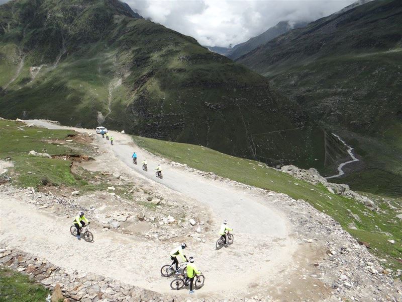
Relatively again an easy day. From Jispa the road continues along the Bhaga River till Darcha. From Darcha the road climbs in switchback turns & gradually leads to Patseo. Good camping site for overnight stay. O/N in camp

Day 6:Patseo – Sarchu (4253mts) ride (68km):

The difficult section of our trip begins today. We would need to be more cautious since we would be staying for next 2-3 days on an average altitude of approx 4400m. From Patseo the hard climb begins for next 30km to Baralacha La 4880m. We pass two small but beautiful lakes of Deepak Tal & Suraj Tal on our way. The views from the pass are rewarding. Road descends from the pass to the plains of Sarchu. O/N in camp
We may decide to camp on at Brandy Nalla making the next day easier.

Day 7:Sarchu – Pang (4630mts) ride (88km):

We continue on the plains of Sarchu for the next 25km before the 10km of switchback climb to Nakila Pass & then descend to Whispy Nallah and again climb to Lachlung La (5065mts) to descend to Pang (4630mts). This is going to be the toughest day of our expedition. O/N in camp
We may decide to break this journey by making a camp at Whispy Nalla.

Day 8:Pang – Debring (4700mts) ride (49km):

Easy day with initial climb to the More Plains / Pang Plateau, the flat section for 42 km to reach Debring at the base of Tanglang La. The arid mountain views on both the sides of the road are a feast. O/N in camp

Day 9:Debring – Upshi (3350mts) ride (80km):

A gradual climb to the top of Tanglang La 5360m. Though the climb is gradual the altitude makes it difficult. Once at the top you are rewarded by some awesome views of the never-ending mountain ranges. From Tanglang La descend for 29km to Rumtse, & then the road continues in a narrow gorge with extremely colorful mountains on both the side, till we exit at Upshi on the banks of Indus River. O/N in camp

Day 10:Upshi – Leh (3500mts) ride (60km)

Easy flat road section till Leh. One can make stopovers to visit Thiksey & Shey monasteries on the way before reaching to Leh. O/N in hotel

Photos
Things to know

What to bring for the tour
Good Warm internal clothing (woolen and fleece, thermals), water proof and wind proof clothing, Comfortable hiking boots with good resistance against the snow and water with a good grip, haversack,  sandals, walking sticks, gaiters, woolen/tennis socks (quite a few pairs) and stocking, gloves, cap, sunglasses (very important), Sunscreen lotion, day sack, camera and binocular (OPTIONAL),  water bottle, torch and batteries

Climate
Day temperature in the sun is pleasant but windy but nights are cold. The temp at night in rain and snow can really go down; sometimes below zero so you have to be well prepared.

Note
It is also possible that a route change may become necessary due to weather, inaccessibility through the mountain passes due to heavy snow, condition of the trail and physical fitness of the clients.

8 travellers are considering this tour right now!