+91-1902-252182, 253050, 252750, +91-9816023004 info@himalayanadventuresindia.com, roopunegi@gmail.com

Southern Zanskar Trek

0
Price
Price
Full Name*
Email Address*
Your Enquiry*
Save To Wish List

Adding item to wishlist requires an account

5744

Why Book With Us?

  • No-hassle best price guarantee
  • Customer care available 24/7
  • Hand-picked Tours & Activities

Get a Question?

Do not hesitate to give us a call. We are an expert team and we are happy to talk to you.

+91-1902-253030, 252182, +91-9816023004

info@himalayanadventuresindia.com

Max People : 28
Tour Details

Trekking Duration   : 16 Days
Altitude  : Min: Manali 2000 Mts.   &  Max: Phirtse La (5,350 Mts.)
Region  : Southern Zanskar & Lahaul – Spiti
Season  : July – September
Grade  : (High Altitude Trek in strenuous category)

The trek starts from Darcha to Sarai Keylong, an oasis in the barren landscape. After crossing Shingo –La (5350Mts.) it takes you to Zanskar here after visiting Phuktal monastery, we take same way back up to Tanje and then from Tanje, we take another valley after crossing Phirtse-La (5250mts), we eventually get at Sarai Keylong.

Itinerary

Day 1:Arrival Chandigarh – Pick Up from Train Station and Drive to Manali - O/night Manali

Day 2:Manali – Pa Lahmo (3,450 Mts.) (Drive) (7-8 Hrs)

As we start our journey, leaving the lush green countryside of Manali towards Rohtang pass (3,978 Mts.). Rohtang Pass – Few places on the Earth can mark so dramatic a change in landscape as the Rohtang Pass. To one side, the lush green head of Kullu Valley; to the other, an awesome vista of bare, chocolate – colored mountains, hanging glaciers and snowfields that shine in the dazzlingly crisp fight. On the Valley floor, we drive through the field of potato and peas, dotted by Lahauli Villages, and we encounter the local inhabitants working in the fields. After crossing a bridge at Tandi, the meeting point of Chandra and Bhaga Rivers, which later becomes Chenab, These Rivers originate from Baralacha La, and flows all the way into the plains of Punjab. From Tandi, the road crosses the River on a bridge and veers north along the Bhaga Valley to Keylong – The district head quarters of Lahaul and Spiti. Keylong is quite a busy town, as it is the only big market in Lahaul Region. There is a Hospital, Collage, Court and other Government offices. As we move further towards Darcha, we see along the River many villages with Buddhist prayer flags and Stupa’s and the landscape also embodies more desert look.
Further to Palahmo. Slowly the landscape changes its appearance, rocks assume human like forms. It is flat easy walk to the last villages of Lahaul, Chhika and Rarik. On the way we meet nice friendly people of this region, from here another stretch of walk along the River (Barai Nallah) to Palahmo. Here is a small temple on the edge of a gorge dedicated to the local Goddess Paldan Lahmo; from this the place has got its name. Standing on the top of the gorge, it is wonderful site to see the tremendous energy with which the water moves through this gorge. After crossing a man made bridge over the Gorge we reach the Camping site.

Day 3:Pa Lahmo – Zanskar Sumdo (3,600 Mts.) (5 Hrs)

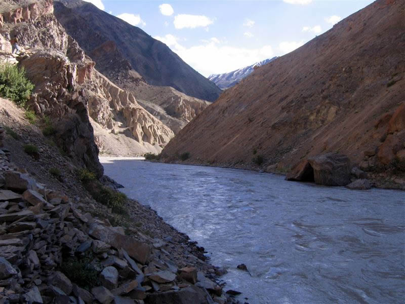
Today’s walk is all along the River (Barai Nallah). The trail winds through the boulders and a small stream crossing ARE involved on the way to get to the campsite, beautiful campsite on the banks of the River (Barai Nallah).

Day 4:Zanskar Sumdo – Chumiknakpo (4,460 Mts.) (7 Hrs)

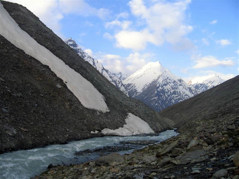
We enter into another valley after crossing a bridge. Comparing to the previous walks, today’s walk is bit hard, as we climb more then 800 Mts. in high altitude conditions. But to compensating the fatigue, it is a tremendous landscape around; there are summits of 6000 Mts. and more all around you. This is a pure alpine region. Finally we reach the campsite, Chumiknakpo, which in local language means black spring.

Day 5:Chumiknakpo – Lakhang (4,060 Mts.) - Over Shingo La (5,100 Mts.)

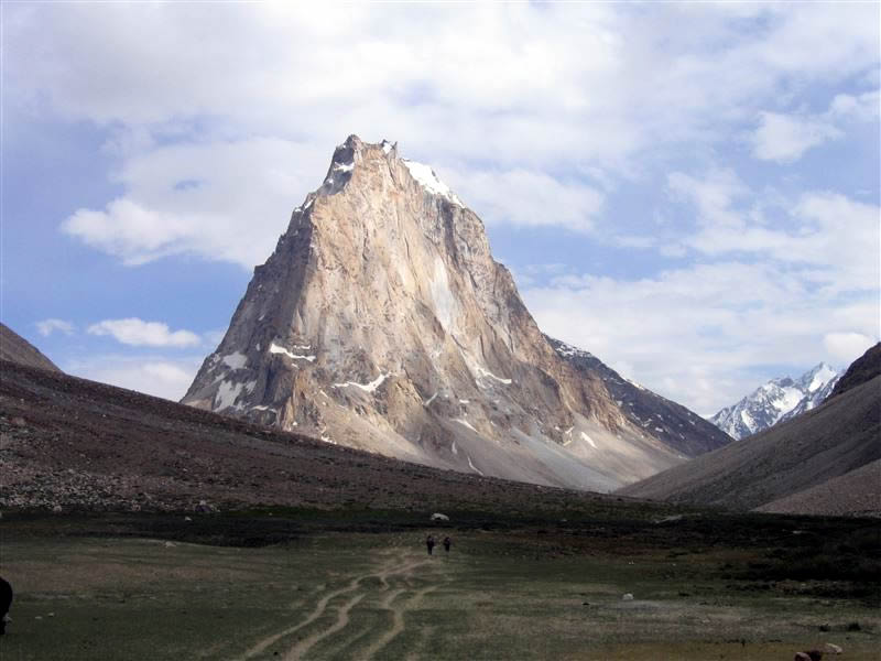
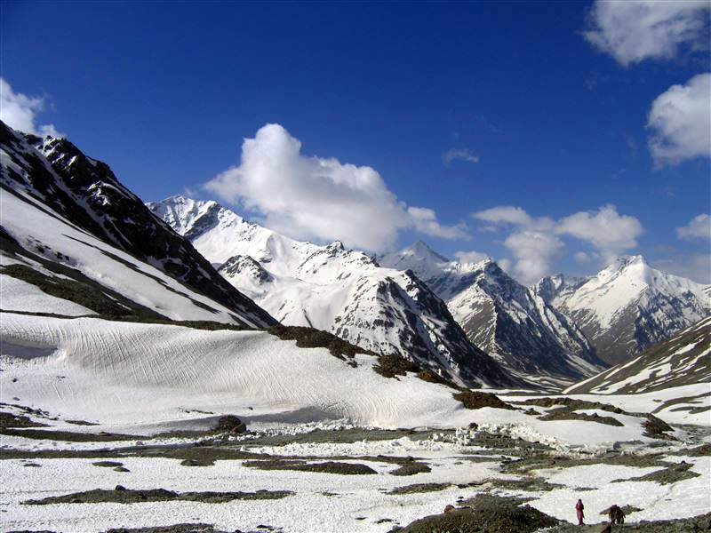
One has to be prepared for the steep as well gradual ascent to the top of the Shingo La. When you reach on the top, here you will be exactly in the heart of the Great Himalayas, at the foot of high summits. To the other side lies completely different World; this is the beginning of mountain desert. In the local language Zanskar means ‘White Copper’ Entering Zanskar, the first sight we catch, is of a mammoth granite rock, magnificently standing in the middle of the Valley. Zanskar have a legend that this is not a sheer rock, instead a monastery, where monks live and pray. During the Tibetan New Year the lucky few can hear, low drumbeats and also see tiny lamps, glimpsing on the rock. This rock is known as Gumburangjon. Lakhang (Camp site) is at the foot of Gumburangjon. Campsite is splendid.

Day 6:Lakhang – Kargiak (4030 Mts.) (5–6 Hrs)

Today we walk through the plains of Zanskar, admiring its lunar landscape, the rocks assume different colors and this mixed with the infinite blue of the sky, makes the atmosphere, a divine one. The walk is all the way along the Kargyak Chu (stream). As we reach Kargyak, the first village of Zanskar, we meet the friendly and warm people of Zanskar. Camp at Kargiak

Day 7:Kargiak – Purne (3700 Mts.) (6 Hrs)

We track all along the Kargyak Chu stream. After crossing the Thangse Bridge, we keep walking on the left bank of the Stream till we reach Testa Village, quite a big village as comparison to other villages in Zanskar. From here we pass through quite a few more hamlets to get to Purne, a small hamlet on top of a hill with three to four houses, belonging to the same family. This is a resting point for trekkers from both sides; this makes it a very commercial center in the middle of this isolated land. You can get form Coke to a bottle of beer here, no matter the prices are almost triple. And below there is a confluence point of Kargyak Chu and Sarap Chu (Chu in local language means river or water) which now becomes Sarap Chu or Zanskar River and would accompany us throughout our Journey in Zanskar. This River is infect used by the local people of Zanskar to travel to Leh and other far Villages in the Winters when it freezes and the thick layer of ice on the top, makes it what is famously called as Chader (Blanket) Route. In the recent times this is getting very famous among the travelers around the World.

Day 8:Purne – Phuktal Monastery – Back To Tangze:

Around two hours walk on a rocky track takes us to the famous Phuktal Monastery. Phuktal Monastery – The imposing and honeycomb monastery of Phuktal is a rare sight and is unmatched in its sublime grandeur. The monastery has been etched out of a composite mountain and has a massive cave. Yellow capped monks, who are hospitable, dominate the monastery and visitors are welcome. Inside the cave there is water whole, whose water remains constantly at the same level. One should not forget to take torch to view magnificent old paintings and thankas in the dark rooms of the Monastery. After visiting the Monastery, we return to Tangze around 3 to 4 hours walk from Phuktal.

Day 9:Tangze – Zingchen (4460 Mts):

Today again nice trek about 5hrs, it is the same way back from here we returns towards Phirtse La valley.

Day 10:Zingchen Over Phirtse La Chhumik Marpo (4600 Mts):

Once again one should start early on nice trail over Phirtse – La (5350 Mts.). There is a mini glacier on the right side and to the left is a mini stone with prayer flags on it. There is a small rocky peak which gives very beautiful view surpassing even the beauty of passes it. On clear day it extends the Karakoram Range to the North. – long day 9hrs

Day 11:Chhumik Marpo – Debni (4360 Mts):-

Again it is wise to start early morning in order to cross the Kamirup which enters the river from the right at Kyonom. By mid day, the route descends over to the left of the river. Camp at Debni—5hrs walk

One more Camp has to be added in case the clients are exhausted.

Day 12:Debni – Sarai Keylong (4400 Mts):

An early, the route is now very beautiful, fords the river and continues until Keylong Sarai entering from the right obstructs the routes. The route continues over the plain into the valley gradually down hill towards Sarai Keylong. It is about 6 hrs walk till the camp from where the National High Way goes to Leh from Manali, drive to Manali.

Day 13:Sarai Keylong – Baralacha – La (4883 Mts)

Route continues on the right bank of the Yamuna river, which comes from Shuru valley and ascends the Baralacha Pass, which means pass with cross trails on the summit. It has trails bisecting from Zanskar, Lahaul, Ladakh, and Spiti. To the South of the pass there are summits of 5-6 thousand mts. From atop the pass superb views of the mighty Western Himalayan peaks are obtained on the way to the campsite.

Day 14:Balaralcha –La – Topkogongma (4640 Mts) 6-7 Hrs:

A three hours descend leads to Topkogongma. There is a stream crossing depending upon the level of the water otherwise you can keep it for another day.

Day 15:Topkogongma – Topkoyongma (4320 Mts) 5-6 Hrs:

An early start is advisable. The scenery is quite barren in a beautiful kind of way and by evening the campsite is reached.

Day 16:Topko Yongma – Chandrataal (4270 Mts) 5-6 Hrs:

After crossing the stream walk through similar terrain as the day before; we reach to the jewel of the lake. The first sight of this wondrous lake takes ones breaths away, with its shores ringed with meadows carpeted with hundreds of varieties of alpine flowers an excellent campsite and a relaxed evening after the rewarding walk. O/N Camp

Day 17:Chandrataal over Kunzum Pass (4551 Mts) 5-6 Hrs to Manali:

An extremely pleasant walk with gradual ascents and descents through some of the most magnificent scenery witnessed in the Lahaul – Spiti region. From the top of the pass, one can view the barren but beautiful landscape towards Spiti. There is a small temple with lot of prayer flags, dedicated to Kunzum Lamo (Local Deity) that is how the pass got its name. This Pass is the origin of Spiti River. We drive down the pass and reach Batal, the Base of the Kunzum Pass, and a nice place for a cup of tea. Further we drive towards Rohthang Pass through Chandra Valley and continue driving on a non-metal road and join the Leh – Manali High way at Gramphu, from here 52 Kms. to Manali- O/night Manali .

Day 18:Day of Rest. O/night Manali .

Day 19:Manali to Chandigarh - Drop

Photos
Things to know

What to bring for the trek
Good Warm internal clothing (woolen and fleece, thermals), water proof and wind proof clothing, Comfortable hiking boots with good resistance against the snow and water with a good grip, haversack,  sandals, walking sticks, gaiters, woolen/tennis socks (quite a few pairs) and stocking, gloves, cap, sunglasses (very important), Sunscreen lotion, day sack, camera and binocular (OPTIONAL),  water bottle, torch and batteries, though the water is very clean and pure and we do provide boiled water once you are in trek  still in order to be extra careful you can get few chlorine pills as mountain water is supposed to be hard.

Climate
Day temperature in the sun is pleasant but windy but nights are cold. The temp at night in rain and snow can really go down; sometimes below zero so you have to be well prepared.

Trek logistics/Services provided during the trek
Accommodation in two men tent (high altitude alpine tents of good quality), heavy foam pad mattress, sleeping bags, Breakfast/tea, all meals (good quality food), services of experienced guide and cook, all the camping equipment, utensils and crockery, kitchen tent, and toilet tent, ponies or porters, adequate medical kit, Transportation during the Trek.

Note
It is also possible that a route change may become necessary due to weather, inaccessibility through the mountain passes due to heavy snow, condition of the trail and physical fitness of the clients.

9 travellers are considering this tour right now!